|
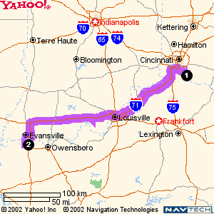
Directions From Lexington, KY!!!
7. Turn Left to take the KY-4 ramp (0.3 miles)
8. Merge on KY-4 (6.0 miles)
9. Take the VERSAILLES RD exit (0.3 miles)
10. Continue on VERSAILLES RD (4.7 miles)
11. Continue on LEXINGTON RD (1.3 miles)
12. Take the BLUE GRASS PKWY ramp (0.6 miles)
13. Merge on BLUE GRASS PKWY (70.5 miles)
14. Take the I-65 SOUTH exit (0.8 miles)
15. Merge on I-65 SOUTH (1.3 miles)
16. Take the Exit 91 exit (0.1 miles)
17. Continue on RAMP (0.5 miles)
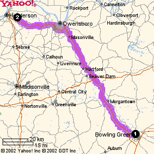
18. Merge on WESTERN KENTUCKY PKWY (59.2 miles)
19. Take the Exit 77 exit (0.4 miles)
20. Merge on the highway (28.8 miles)
21. Take the US-60 BYP exit (0.2 miles)
22. Merge on US-60 BYP (6.6 miles)
23. Take the AUDUBON PKWY exit (0.5 miles)
24. Merge on AUDUBON PKWY (17.6 miles)
25. Take the Exit 5 exit (0.4 miles)
26. Continue on STATE ROUTE 1078 S (2.0 miles)
27. Turn Left on E MILL RD/E MILL ST/MILL ST (0.1 miles)
28. Turn Left on ZION RD (0.4 miles)
Distance: 204.1 miles Approximate Travel Time: 3 hours 38 mins
Questions? Contact Us!!!
Directions From Bowling Green & Russellville
FROM BOWLING GREEN
1. Take the William Natcher Parkway
2. Merge on US-60 BYP go around Owensborow (6.6 miles)
3. Take the AUDUBON PKWY exit (0.5 miles)
4. Merge on AUDUBON PKWY (17.6 miles, Toll .50 cents)
5. Take the Zion exit (0.4 miles)
6. Turn Right onto Hwy 1078
7. Continue on STATE ROUTE 1078 (3 miles, Curvey Rd.)
8. Zion Baptist will be on your Right
FROM RUSSELVILLE!!
1. Take 68 West to Hopkinsville.
2. Take Pennyrile PKWy North to Henderson (72 miles)
3. Take the Henderson Zion exit (Hwy 351)
4. At the bottom of the exit turn Left on Hwy 351 (4-5 miles)
5. You'll see Zion Store on your Right.(go 100 more yards)
6. Zion Baptist Church will be on your right.
7. Just before the Church building the Parking will be on your Left!
Questions? Contact Us!!!
|
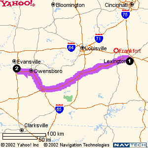 Map From Lexington to The Chruch!!!
We're sure that most people coming from Lexington are quite familiar with this beautiful drive! Please e-mail us if you have any additional questions.
Map From Lexington to The Chruch!!!
We're sure that most people coming from Lexington are quite familiar with this beautiful drive! Please e-mail us if you have any additional questions. |